The dashboard is presented with 2 main layers: map layer and density layer. Navigation in GeoPulse dashboard are provided below:
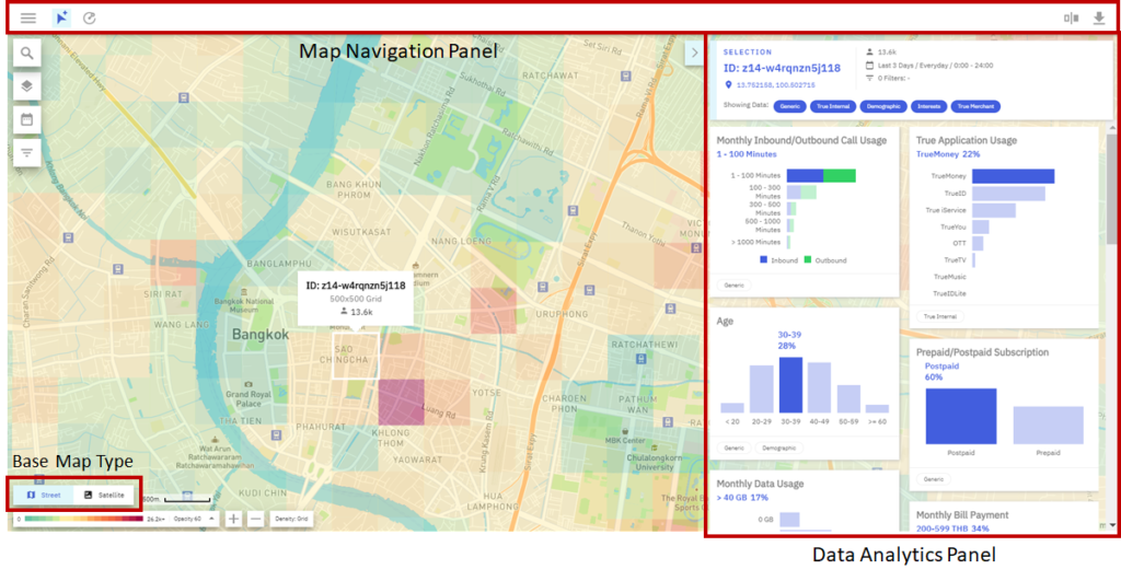
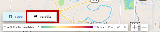
Base Map Type
GeoPulse’s base map supports both Street mode and Satellite mode. This function is accessible from the bottom left corner of the screen.
Current Location
When the user clicks on the current location button, the web browser will ask for users’ location permission. Once location permission is allowed, GeoPulse viewport will go to the user’s current location (current latitude and longitude). In order to provide convenience to users and prevent the user from having to manually search for the location on the map.
